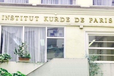
BibliothÃĻque Kurde de Paris
 Accueil
CATALOGUE EN CONSTRUCTION / CATALOG UNDER CONSTRUCTION
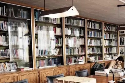
Environ 13 000 documents rÃĐpertoriÃĐs. Informations complÃĐmentaires sur demande.
About 13,000 documents listed. Additional data on request.
OUVERTURE: LUNDI-VENDREDI 13-18 h / OPEN MONDAY-FRIDAY 1-6 PM
DÃĐtail de l'indexation
1300 : ErdnÃŪgarÃŪ & aborÃŪ, giÅtÃŪ | GÃĐographie & ÃĐconomie, gÃĐnÃĐral | Geography & economics, general | ØŽŲÚŊØąØ§ŲÛا Ų ØĶاØĻŲŲØąÛ ÚŊØīØŠÛ |
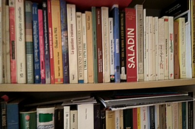
Ouvrages de la bibliothèque en indexation 1300 (85)

 Faire une suggestion Affiner la recherche
LÊkolÃŪneweyek le cugrafiyay Kurdistan ; ŲÛŲÛŲÛŲÛŲÛÛÛŲ ŲÛ ØŽŲÚŊØąØ§ŲÛØ§Û ŲÛØąÛŲ Û ŲŲØąØŊØģ؊اŲ / ŲاŲÚÛ ÛاØģÛŲ Ų ØÛŲ Ų ÛØŊØĶÛŲ ÛŲ (2013)
Titre : LÊkolÃŪneweyek le cugrafiyay Kurdistan ; ŲÛŲÛŲÛŲÛŲÛÛÛŲ ŲÛ ØŽŲÚŊØąØ§ŲÛØ§Û ŲÛØąÛŲ Û ŲŲØąØŊØģ؊اŲ Titre original : [Recherches sur la gÃĐographie du Kurdistan] Type de document : texte imprimÃĐ Auteurs : ŲاŲÚÛ ÛاØģÛŲ Ų ØÛŲ Ų ÛØŊØĶÛŲ ÛŲ, Auteur Mention d'ÃĐdition : 2e ÃĐd. Editeur : SilÊmanÃŪ [Irak, Kurdistan] : XezelnÃŧs AnnÃĐe de publication : 2013 Importance : 330 p. Langues : Kurde (kur) Kurde central (soranÃŪ) (ckb) Mots-clÃĐs : GÃĐographie Grand Kurdistan Index. dÃĐcimale : 1300 Erdnîgarî & aborî, giÅtî | Géographie & économie, général | Geography & economics, general | ØŽŲÚŊØąØ§ŲÛا Ų ØĶاØĻŲŲØąÛ ÚŊØīØŠÛ Permalink : https://pmb.institutkurde.org/opac_css/index.php?lvl=notice_display&id=9903 LÊkolÃŪneweyek le cugrafiyay Kurdistan ; ŲÛŲÛŲÛŲÛŲÛÛÛŲ ŲÛ ØŽŲÚŊØąØ§ŲÛØ§Û ŲÛØąÛŲ Û ŲŲØąØŊØģ؊اŲ = [Recherches sur la gÃĐographie du Kurdistan] [texte imprimÃĐ] / ŲاŲÚÛ ÛاØģÛŲ Ų ØÛŲ Ų ÛØŊØĶÛŲ ÛŲ, Auteur . - 2e ÃĐd. . - SilÊmanÃŪ [Irak, Kurdistan] : XezelnÃŧs, 2013 . - 330 p.
Langues : Kurde (kur) Kurde central (soranÃŪ) (ckb)
Mots-clÃĐs : GÃĐographie Grand Kurdistan Index. dÃĐcimale : 1300 Erdnîgarî & aborî, giÅtî | Géographie & économie, général | Geography & economics, general | ØŽŲÚŊØąØ§ŲÛا Ų ØĶاØĻŲŲØąÛ ÚŊØīØŠÛ Permalink : https://pmb.institutkurde.org/opac_css/index.php?lvl=notice_display&id=9903 Exemplaires (1)
Code-barres Cote Support Localisation Section DisponibilitÃĐ IKPLIV106082 1300 MIH LEK Livre 1- Salle de lecture | Reading room 1.13 Géographie, économie (1300...) Exclu du prÊt
Titre : The Levant behind the Arab curtain Type de document : texte imprimÃĐ Auteurs : David Cohen, Auteur Editeur : New York, NY [USA] : Levant Press AnnÃĐe de publication : 1952 Importance : 63 p. Langues : Anglais (eng) Mots-clÃĐs : Economie GÃĐographie Agriculture Climatologie Euphrate MÃĐsopotamie. Index. dÃĐcimale : 1300 Erdnîgarî & aborî, giÅtî | Géographie & économie, général | Geography & economics, general | ØŽŲÚŊØąØ§ŲÛا Ų ØĶاØĻŲŲØąÛ ÚŊØīØŠÛ Note de contenu : 6 - Arabs and Arabism, fact or fiction? - Khalil, Louis
9 - The Semitic Levant, present conditions - Gourevitch, Adolphe
31 - The Maronites of Lebanon - Ghosn, Albert Kh.
43 - Israel and Zionism: why Israel has no constitution - Jabotinsky, Eri
51 - The freedom of Egypt's Copts - Sergios, Right Reverend Al-Qumos
53 - Economic prospects in the Euphrates country - Cohen, DavidPermalink : https://pmb.institutkurde.org/opac_css/index.php?lvl=notice_display&id=10628 The Levant behind the Arab curtain [texte imprimÃĐ] / David Cohen, Auteur . - New York, NY [USA] : Levant Press, 1952 . - 63 p.
Langues : Anglais (eng)
Mots-clÃĐs : Economie GÃĐographie Agriculture Climatologie Euphrate MÃĐsopotamie. Index. dÃĐcimale : 1300 Erdnîgarî & aborî, giÅtî | Géographie & économie, général | Geography & economics, general | ØŽŲÚŊØąØ§ŲÛا Ų ØĶاØĻŲŲØąÛ ÚŊØīØŠÛ Note de contenu : 6 - Arabs and Arabism, fact or fiction? - Khalil, Louis
9 - The Semitic Levant, present conditions - Gourevitch, Adolphe
31 - The Maronites of Lebanon - Ghosn, Albert Kh.
43 - Israel and Zionism: why Israel has no constitution - Jabotinsky, Eri
51 - The freedom of Egypt's Copts - Sergios, Right Reverend Al-Qumos
53 - Economic prospects in the Euphrates country - Cohen, DavidPermalink : https://pmb.institutkurde.org/opac_css/index.php?lvl=notice_display&id=10628 Exemplaires (1)
Code-barres Cote Support Localisation Section DisponibilitÃĐ IKPBRO100073 BR 73 Brochure 2- Bureau bibliothécaire | Librarian's office 2.03 Boîtes archives brochures Exclu du prÊt
Titre de sÃĐrie : Maghreb Machrek, 196 Titre : Les batailles de l'eau Type de document : texte imprimÃĐ Auteurs : Pierre Blanc (1966-....), Ãditeur scientifique ; Barah MikaiĖl, Ãditeur scientifique Editeur : Paris [France] : Choiseul AnnÃĐe de publication : 2008 Collection : Maghreb Machrek Importance : 142 p. PrÃĐsentation : Illustrations, cartes Format : 23 cm ISBN/ISSN/EAN : 978-2-916722-34-4 Prix : 20 EUR Langues : Français (fre) Mots-clÃĐs : Eau, Politique publique, Proche-Orient, Syrie, aspect environnemental, aspect eĖconomique, Gestion des ressources en eau Index. dÃĐcimale : 1300 Erdnîgarî & aborî, giÅtî | Géographie & économie, général | Geography & economics, general | ØŽŲÚŊØąØ§ŲÛا Ų ØĶاØĻŲŲØąÛ ÚŊØīØŠÛ Permalink : https://pmb.institutkurde.org/opac_css/index.php?lvl=notice_display&id=4144 Maghreb Machrek, 196. Les batailles de l'eau [texte imprimÃĐ] / Pierre Blanc (1966-....), Ãditeur scientifique ; Barah MikaiĖl, Ãditeur scientifique . - Paris [France] : Choiseul, 2008 . - 142 p. : Illustrations, cartes ; 23 cm. - (Maghreb Machrek) .
ISBN : 978-2-916722-34-4 : 20 EUR
Langues : Français (fre)
Mots-clÃĐs : Eau, Politique publique, Proche-Orient, Syrie, aspect environnemental, aspect eĖconomique, Gestion des ressources en eau Index. dÃĐcimale : 1300 Erdnîgarî & aborî, giÅtî | Géographie & économie, général | Geography & economics, general | ØŽŲÚŊØąØ§ŲÛا Ų ØĶاØĻŲŲØąÛ ÚŊØīØŠÛ Permalink : https://pmb.institutkurde.org/opac_css/index.php?lvl=notice_display&id=4144 Map of Kurdistan from 1946 (1946)


Titre : Map of Kurdistan from 1946 Type de document : document ÃĐlectronique Editeur : Le Caire : Elias Modern press AnnÃĐe de publication : 1946 Note gÃĐnÃĐrale : Map of Kurdistan published in 1946 by Elias Modern Press in Cairo by elements of the Kurdish diaspora in Egypt. Langues : Français (fre) Mots-clÃĐs : Carte gÃĐographique Index. dÃĐcimale : 1300 Erdnîgarî & aborî, giÅtî | Géographie & économie, général | Geography & economics, general | ØŽŲÚŊØąØ§ŲÛا Ų ØĶاØĻŲŲØąÛ ÚŊØīØŠÛ Note de contenu : According to Maria T. O'Shea's 2004 Trapped Between Map and Reality: Geography and Perceptions of Kurdistan, p. 153, the map was "the first Kurdish projection of the whole of Kurdistan to be aimed at the outside world" and "unique in that it had an accompanying text to justify the positions taken."
According to the map's French legend, "Les frontiÃĻres ethniques du Kurdistan sont indiquÃĐes par une zÃīne de hachures d'autant plus mince que la dÃĐlimitation est plus nette
Les autres zÃīnes hachurÃĐes indiquent la position et l'ÃĐtendre appoximative des groupements isolÃĐs."
According to the accompanying explanatory pamphlet in English "Areas marked by hatchings are those about which information is indefinite."
Subsequently, the uncertainty indicated by the hatching has frequently been ignored. The inclusion of lands that would have granted a putative post-WWII Kurdish state access to the Persian Gulf was a characteristic of other maps, produced for diplomatic purposes, in 1945 and 1946.
See the discussion in O'Shea's Trapped Between Map and Reality, pp. 150â156. The map is reproduced in blank-and-white outline as figure 12.5 on page 151.
The provided link leads to American Geographical Society Library Digital Map Collection American Geographical Society Library, University of Wisconsin-Milwaukee Libraries University of Wisconsin-Milwaukee.En ligne : https://collections.lib.uwm.edu/digital/collection/agdm/id/5773 Format de la ressource ÃĐlectronique : Image Permalink : https://pmb.institutkurde.org/opac_css/index.php?lvl=notice_display&id=10573 Map of Kurdistan from 1946 [document ÃĐlectronique] . - Le Caire : Elias Modern press, 1946.
Map of Kurdistan published in 1946 by Elias Modern Press in Cairo by elements of the Kurdish diaspora in Egypt.
Langues : Français (fre)
Mots-clÃĐs : Carte gÃĐographique Index. dÃĐcimale : 1300 Erdnîgarî & aborî, giÅtî | Géographie & économie, général | Geography & economics, general | ØŽŲÚŊØąØ§ŲÛا Ų ØĶاØĻŲŲØąÛ ÚŊØīØŠÛ Note de contenu : According to Maria T. O'Shea's 2004 Trapped Between Map and Reality: Geography and Perceptions of Kurdistan, p. 153, the map was "the first Kurdish projection of the whole of Kurdistan to be aimed at the outside world" and "unique in that it had an accompanying text to justify the positions taken."
According to the map's French legend, "Les frontiÃĻres ethniques du Kurdistan sont indiquÃĐes par une zÃīne de hachures d'autant plus mince que la dÃĐlimitation est plus nette
Les autres zÃīnes hachurÃĐes indiquent la position et l'ÃĐtendre appoximative des groupements isolÃĐs."
According to the accompanying explanatory pamphlet in English "Areas marked by hatchings are those about which information is indefinite."
Subsequently, the uncertainty indicated by the hatching has frequently been ignored. The inclusion of lands that would have granted a putative post-WWII Kurdish state access to the Persian Gulf was a characteristic of other maps, produced for diplomatic purposes, in 1945 and 1946.
See the discussion in O'Shea's Trapped Between Map and Reality, pp. 150â156. The map is reproduced in blank-and-white outline as figure 12.5 on page 151.
The provided link leads to American Geographical Society Library Digital Map Collection American Geographical Society Library, University of Wisconsin-Milwaukee Libraries University of Wisconsin-Milwaukee.En ligne : https://collections.lib.uwm.edu/digital/collection/agdm/id/5773 Format de la ressource ÃĐlectronique : Image Permalink : https://pmb.institutkurde.org/opac_css/index.php?lvl=notice_display&id=10573 SupplÃĐmentsDocuments numÃĐriques

1946_Kurdistan_et_groupements_Kurdes_isolésImage Jpeg
Titre : La MÃĐditerranÃĐe et le Moyen-Orient. Tome 1 : la MÃĐditerranÃĐe occidentale Type de document : texte imprimÃĐ Auteurs : Pierre Birot, Auteur ; Jean Dresch, Auteur Editeur : Paris [France] : Presses universitaires de France (PUF) AnnÃĐe de publication : 1953 Collection : Orbis Importance : 547 p. PrÃĐsentation : Cartes. Note gÃĐnÃĐrale : Ancien numéro : 1982 Langues : Français (fre) Mots-clÃĐs : GÃĐographie physique et humaine MÃĐditerranÃĐe PÃĐninsule ibÃĐrique Italie Afrique du nord Index. dÃĐcimale : 1300 Erdnîgarî & aborî, giÅtî | Géographie & économie, général | Geography & economics, general | ØŽŲÚŊØąØ§ŲÛا Ų ØĶاØĻŲŲØąÛ ÚŊØīØŠÛ Permalink : https://pmb.institutkurde.org/opac_css/index.php?lvl=notice_display&id=15322 La MÃĐditerranÃĐe et le Moyen-Orient. Tome 1 : la MÃĐditerranÃĐe occidentale [texte imprimÃĐ] / Pierre Birot, Auteur ; Jean Dresch, Auteur . - Paris [France] : Presses universitaires de France (PUF), 1953 . - 547 p. : Cartes.. - (Orbis) .
Ancien numéro : 1982
Langues : Français (fre)
Mots-clÃĐs : GÃĐographie physique et humaine MÃĐditerranÃĐe PÃĐninsule ibÃĐrique Italie Afrique du nord Index. dÃĐcimale : 1300 Erdnîgarî & aborî, giÅtî | Géographie & économie, général | Geography & economics, general | ØŽŲÚŊØąØ§ŲÛا Ų ØĶاØĻŲŲØąÛ ÚŊØīØŠÛ Permalink : https://pmb.institutkurde.org/opac_css/index.php?lvl=notice_display&id=15322 Exemplaires (1)
Code-barres Cote Support Localisation Section DisponibilitÃĐ IKPLIV109208 1300 BIR MED Livre 4- Magasin principal (RdC) | Main store (ground floor) 4.01 Etagères générales RdC Exclu du prÊt
PermalinkPermalinkPermalinkPermalinkPermalinkPermalinkPermalinkPermalinkPermalinkPermalink